TOUK Brecon Rally Route - 14 Oct 2023
Meet/Departure Point - eastbound M4 Sarn Services (8x V2 SuC available)
Departure time - aiming for 11:00
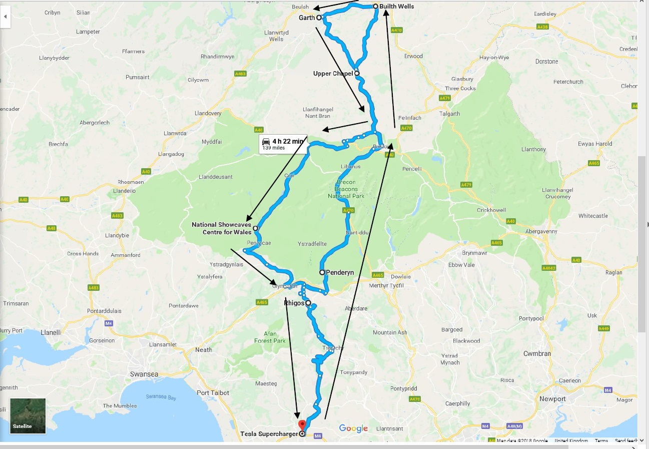
Overview of route below…
At the time of writing, the number of drivers is still to be confirmed but it is possible that we will have up to 15+ cars given the early poll taken in Aug. Therefore, local drivers are asked to arrive at Sarn with as much charge as possible to reduce congestion on the SuC’s for those that have travelled long distances and/or need a full charge.
For supercharging prior to getting here, Cardiff V3 SUC (CCS only) is available just off the M4 or if travelling down the M5 you have Michaelwood Services, if travelling up from the South West you have Gordano, and Cribbs, and from the East there is Membury on the M4.
There are GridServe/Ecotricity chargers at most of the motorway services on the M4, but as with all public charging it’ll be hit and miss as to whether they are in use or not.
If you haven’t been to Wales before or for a while, there is no longer a toll bridge on the M4 to cross the River Severn - it's now free to get in.
The stages of the route are detailed below (it’s pretty loooong) - don’t worry, you don’t need to digest all of it (the sheep part is pretty important though) as it’s just here if you somehow get mislaid along the way ;) . A brief of the route will be given to all drivers at Sarn before departure.
Sarn departure
Depending on final numbers, we will aim to depart Sarn as a convoy. There is a Facebook Messenger Group setup for the event (contact me if you want to be added)
We would ask that you please respect the speed limit at all times - there are a couple of fixed cameras en-route, one within the first mile or so and South Wales police have an active team of mobile cameras.
20 mph is now the default speed limit within villages and towns - this replaces the 30mph limit you might be used to. Please ignore your satnav as it most likely will be telling you the wrong speed limit.
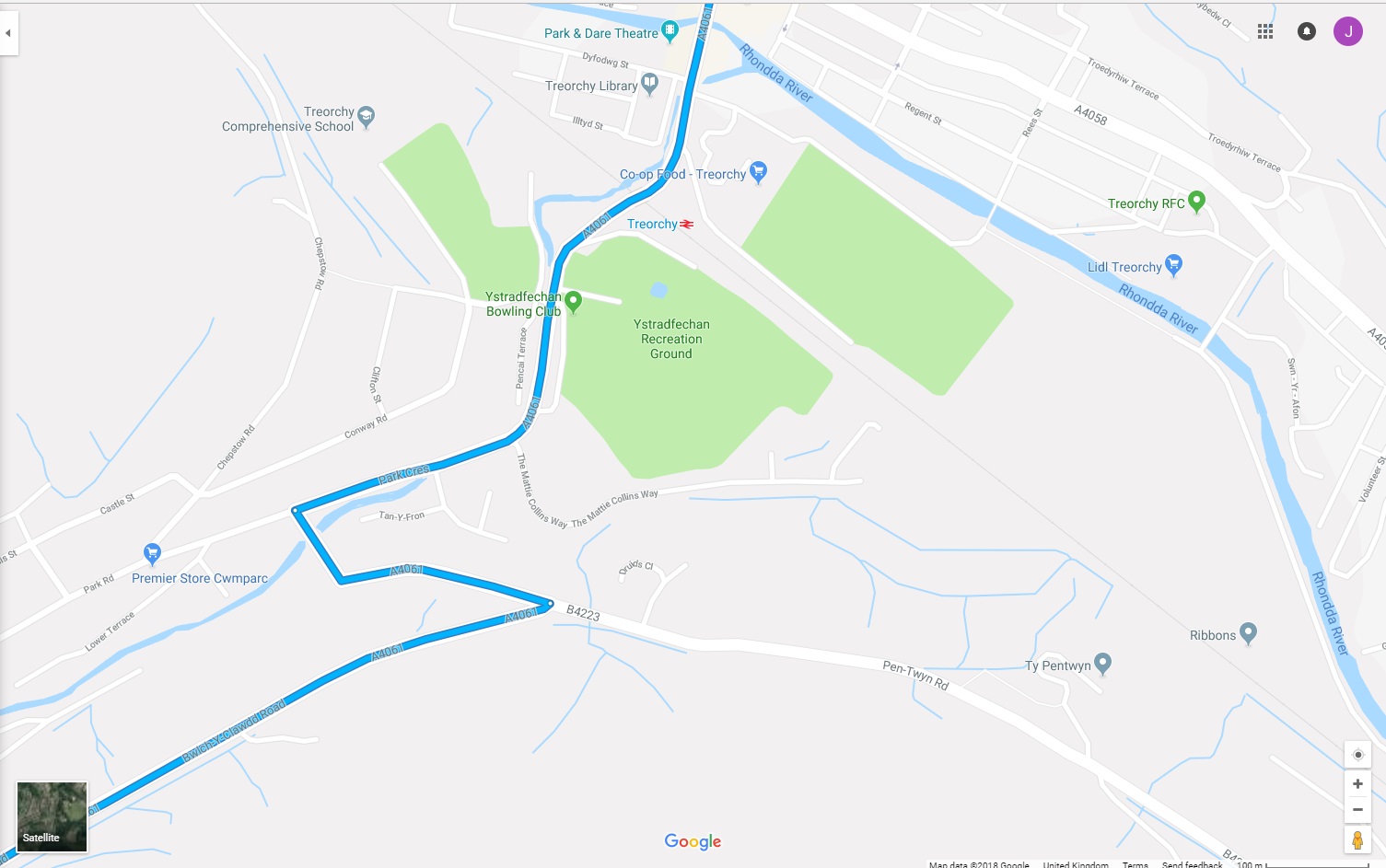
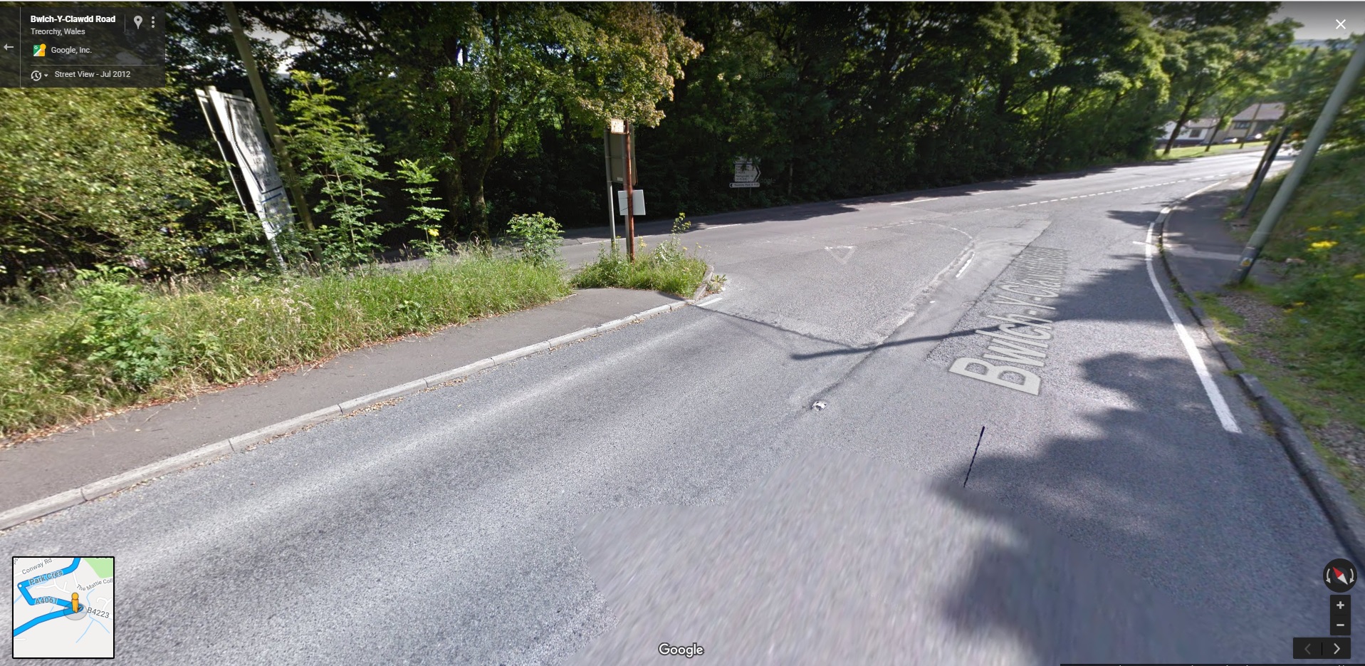
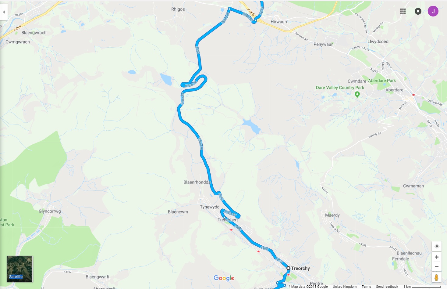
Stage 1. Sarn - Treorchy (A4061)
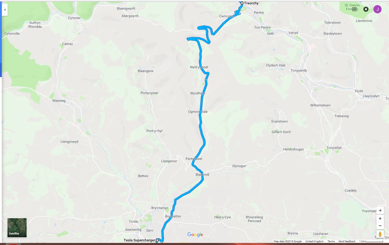
A mixture of fast cross country roads and a bit of twisty stuff as we approach Treorchy…
Dropping down into the valley, Treorchy will be on our left . There is a sharp left as we approach the bottom of the valley and enter the town.
Probably a good time to mention sheep.
They ‘own’ these roads and they are pretty thick. Granted, we have loads of them, but when you see one, treat them with the utmost ‘respect’, in that if you don’t, they will likely just jump straight out into the road and trash the front of your car - when kebab meets car - kebab always wins in this case!!
El Presidente, thwacked a magpie at Silverstone and it knocked out his aircon !!. A sheep-strike could result in a speed dial call to James Allenby!
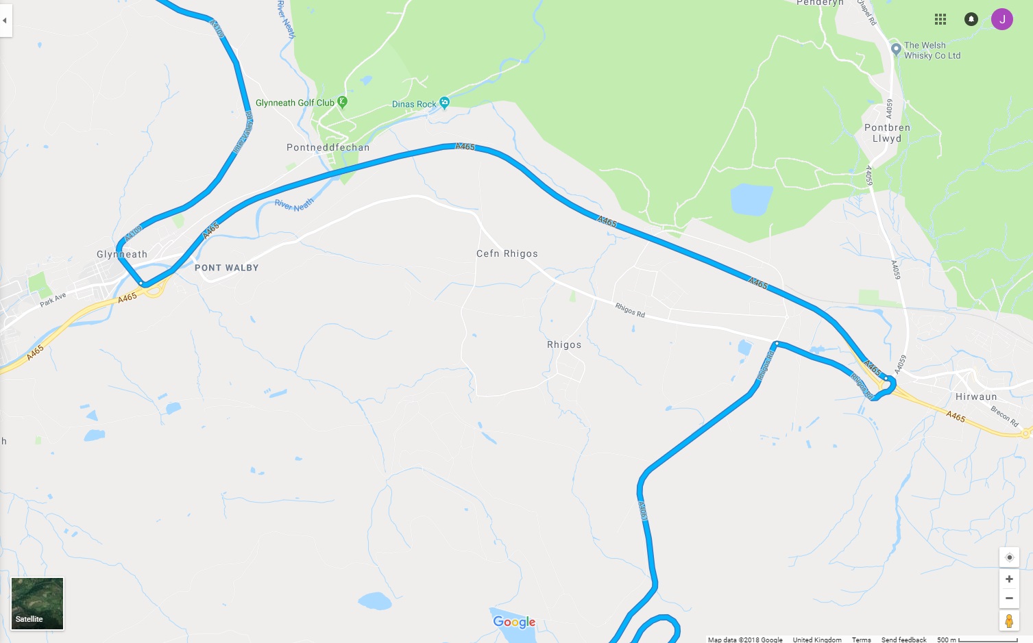
Stage 2. Treorchy - Hirwaun (A4061)
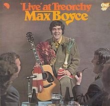
Continue along A4061 through Treorchy and Treherbert (this may be a pain and take a few minutes) until we climb back into the countryside. Fun fact whilst cruising through Treorchy - Max Boyce released the album that made his name from here “Max Boyce - Live at Treorchy”.
Possible Spotify moment ;)
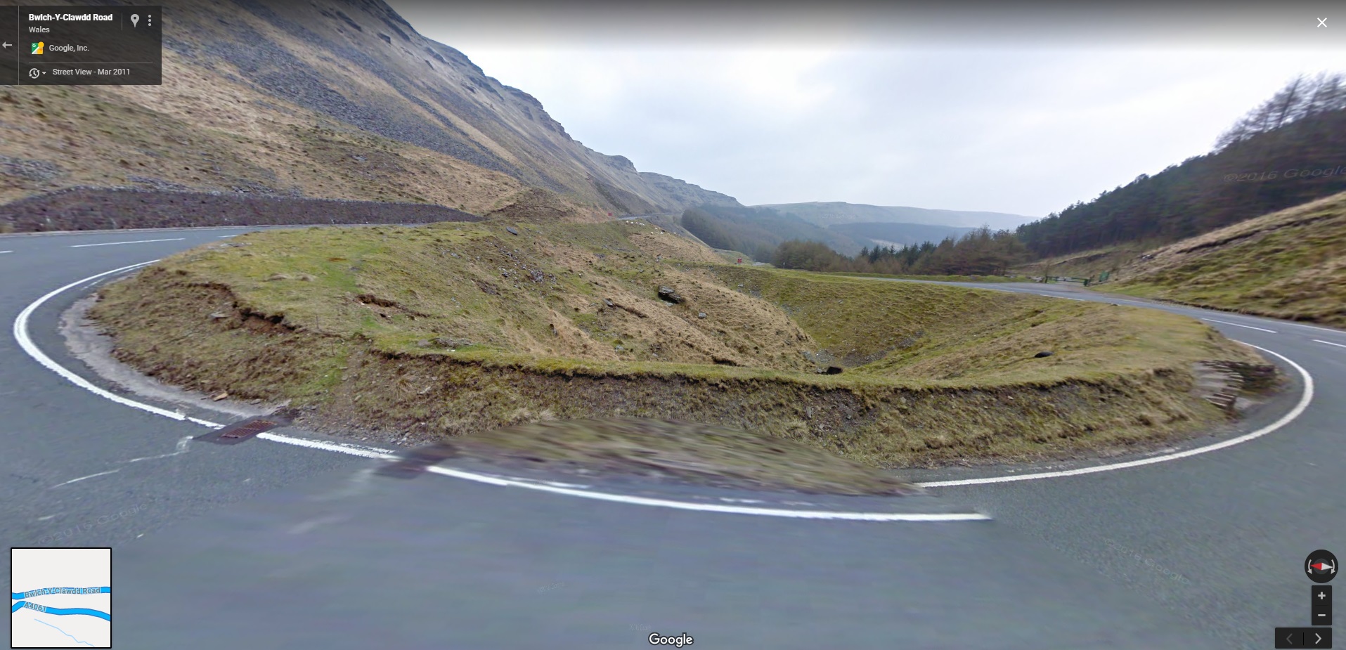
This route is similar to the previous one with fast sections followed by a few slow bends…
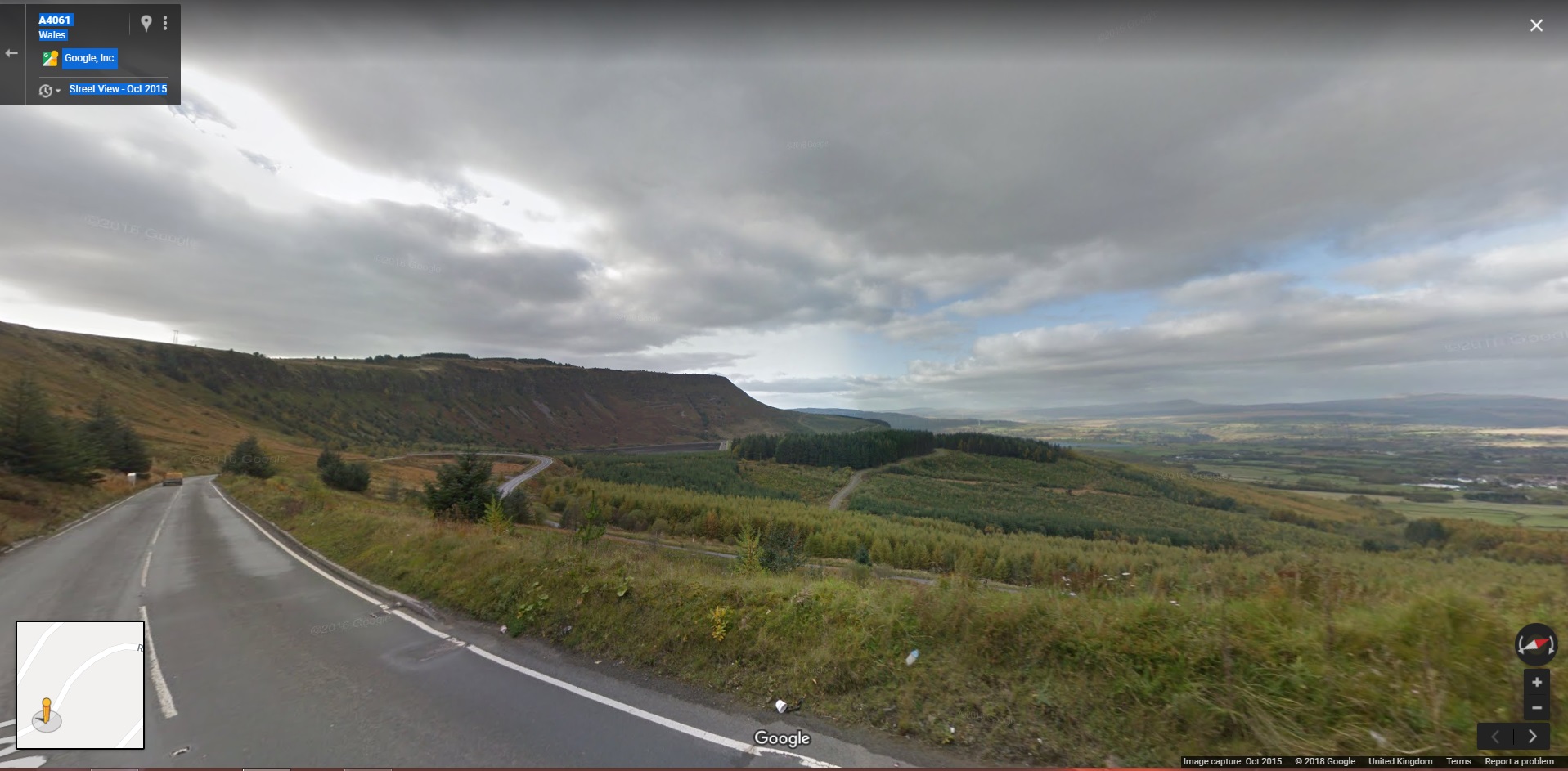
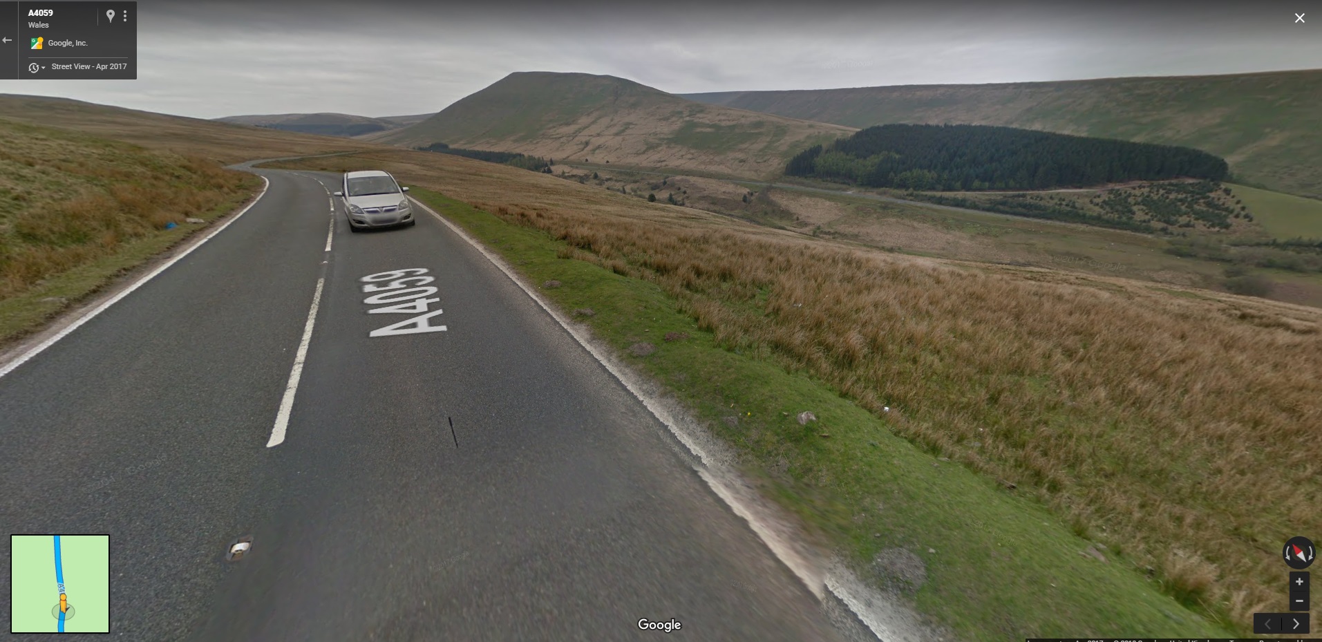
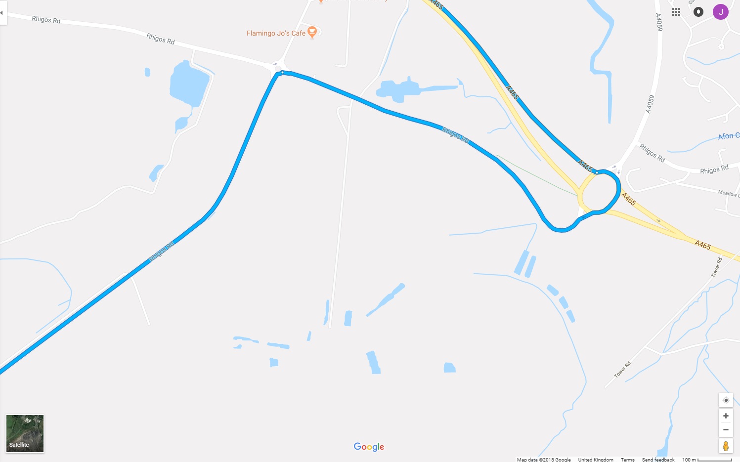
Stage 3. Hirwaun - Brecon National Park Visitor centre (A4059 -> A470)
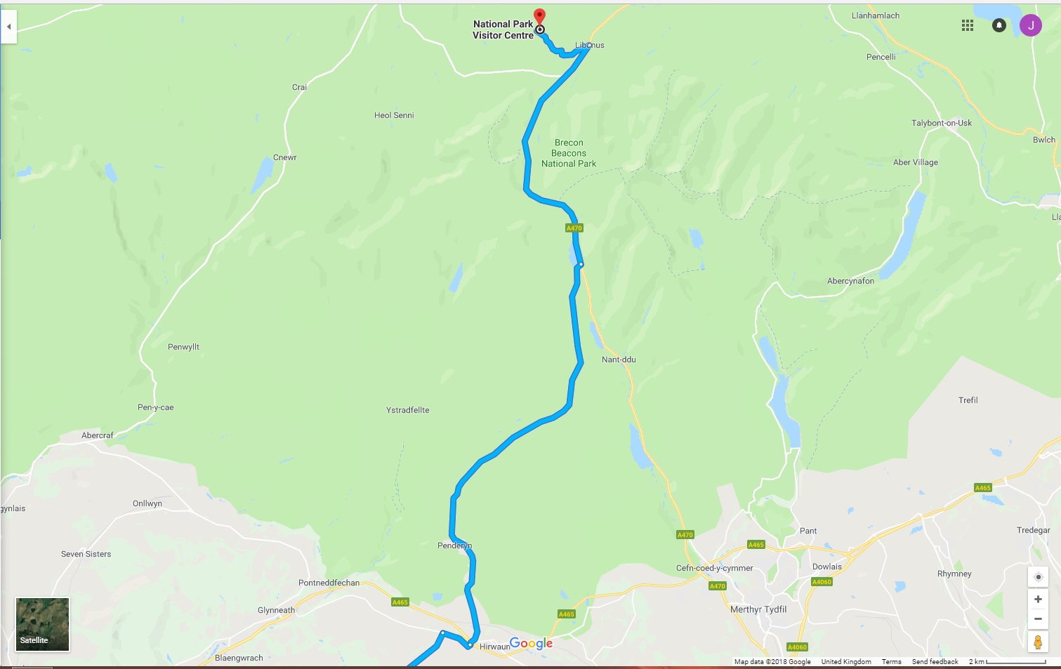
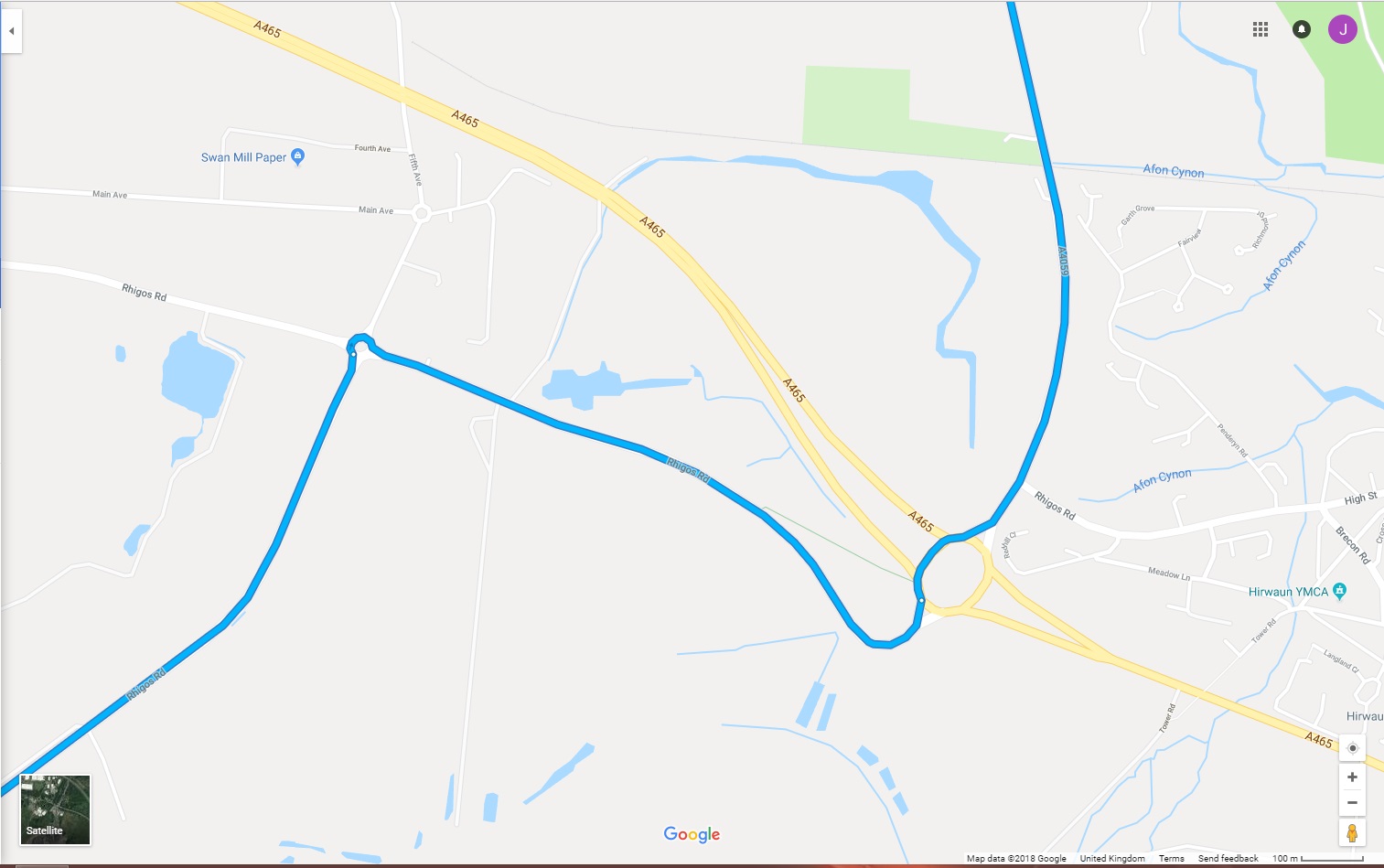
At the end of the A4061 there is a mini roundabout at Rhigos. Take the 3rd exit (Rhigos Road) towards Hirwaun and then at the next ‘larger’ roundabout, take the northbound A4059 towards Brecon.
It’s this stage of the route where we’ll pass Penderyn distillery, the shop there is open seven days a week so if anybody fancies picking up a bottle of Brecon Gin or Penderyn Whisky then this will be your chance.
I’ve messaged them to see if we can stop there briefly as they have a decent car-park area which might be good opportunity for a group photo and to collect any stragglers we may have created by then. (I also always like to support business that support us with charging support - 2 DC’s available). This small ‘staging’ route will open up after we pass the distillery and become a moorland/hill road - fast and open with some sweeping bends and views of the Brecons.
The A4059 will join the A470 on the way to the Visitor Centre - keep an eye out for a reservoir ahead as we descend, that’ll be a visual clue to the junction coming up (left turn at the junction).
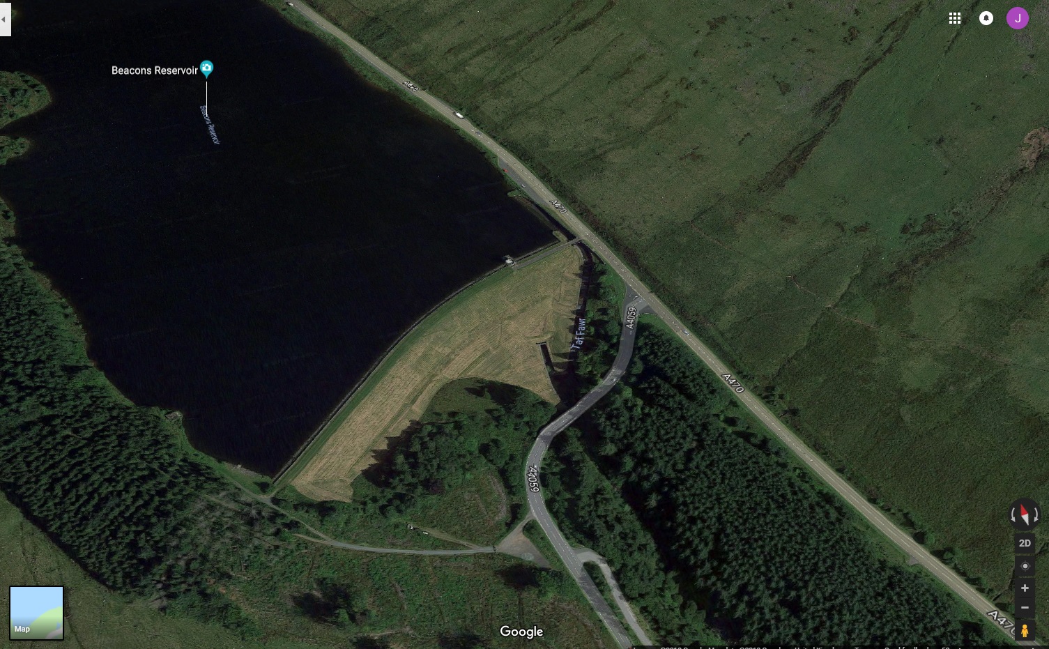
Turn left onto the A470 towards Libanus, the Visitor Centre will be a left turn on entering Libanus (red 50mph road markings should be the final alert).
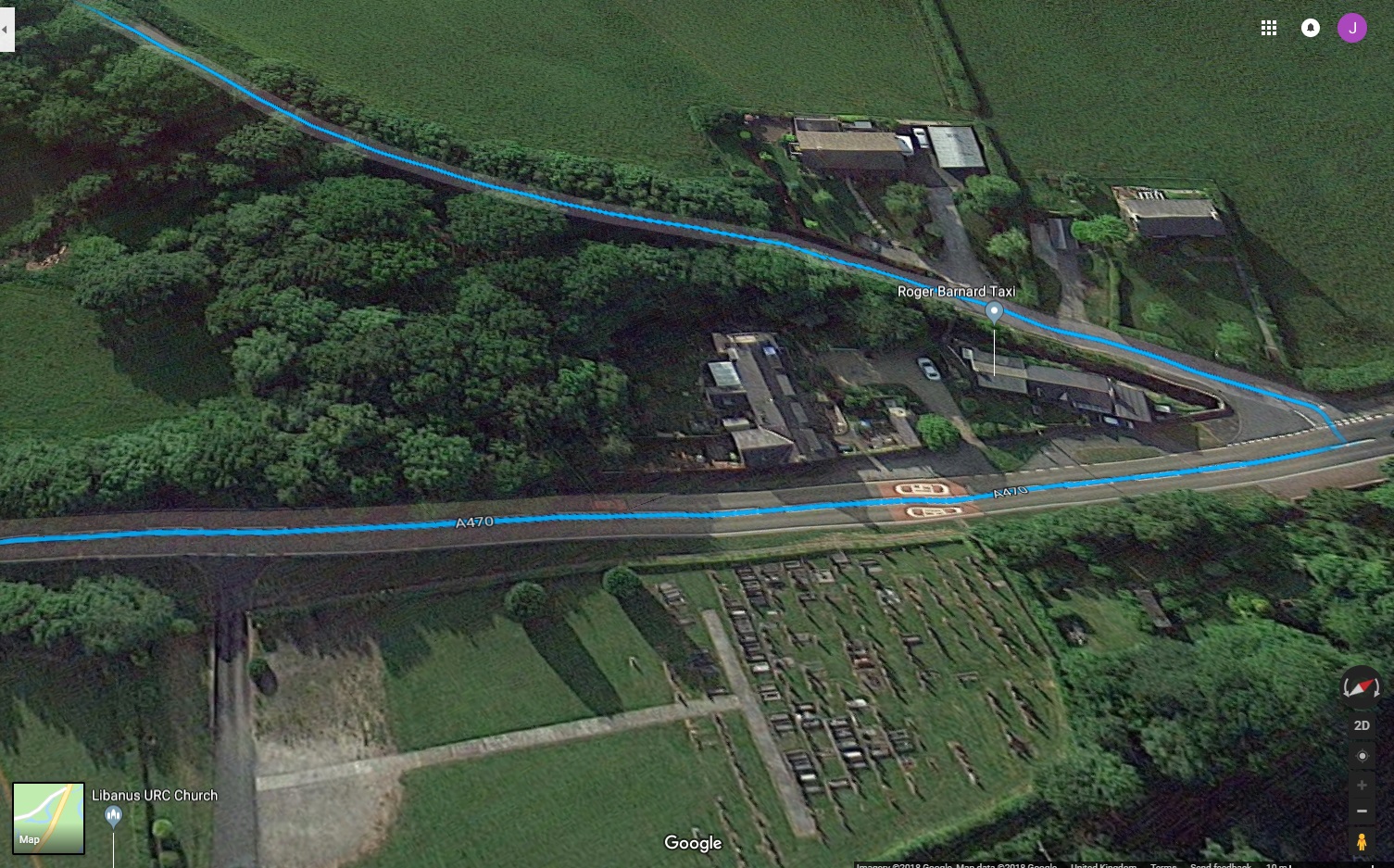
Ok, I’ll not lie, this road is not built for a convoy of Tesla’s. We may need to dispatch a ‘runner’ ahead with a radio to authorize vehicles up. Will assess on the day and react accordingly - all part of the fun (he says hopefully).
We will hopefully be able to park up in the overflow area as there’s a nice bit of well kept grass which will make a good photo opportunity.
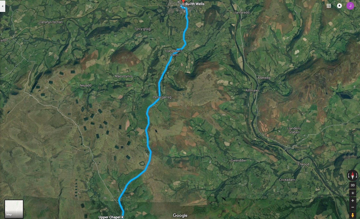
Stage 4. Libanus - Upper Chapel (A470 -> B4601 -> B4520)
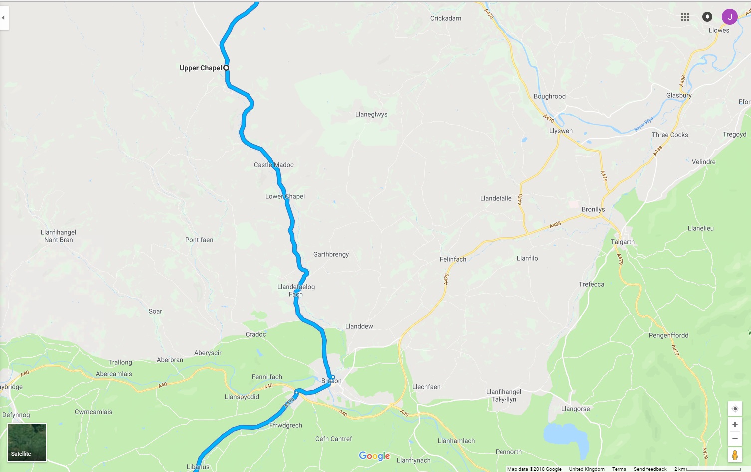
Follow the A470 into Brecon and then take the 3rd exit at the roundabout onto the B4601. Mosey on through the town following the B4061 on the route below…
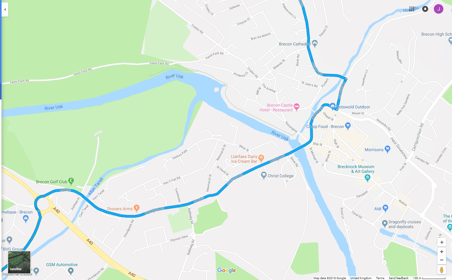
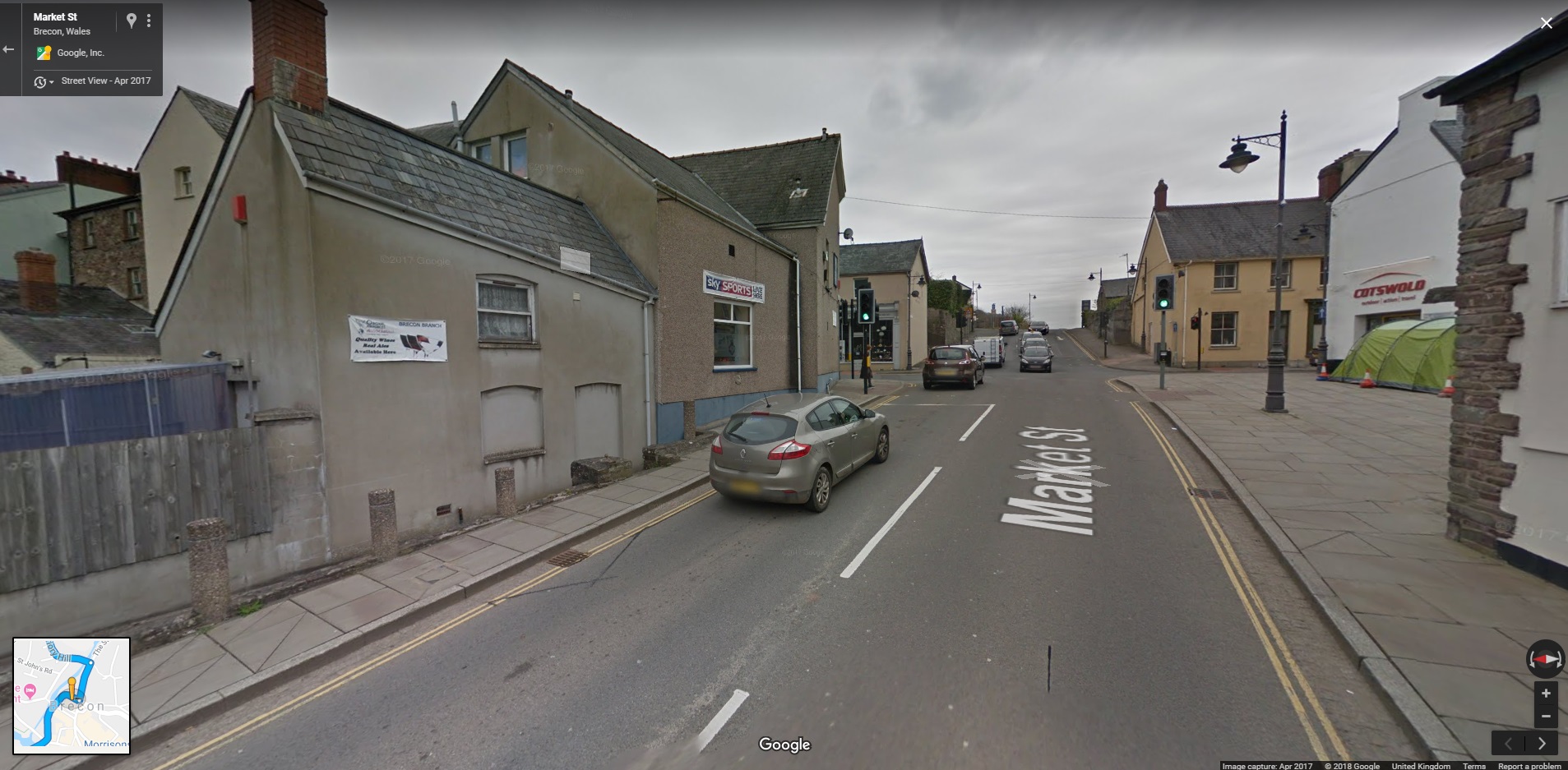
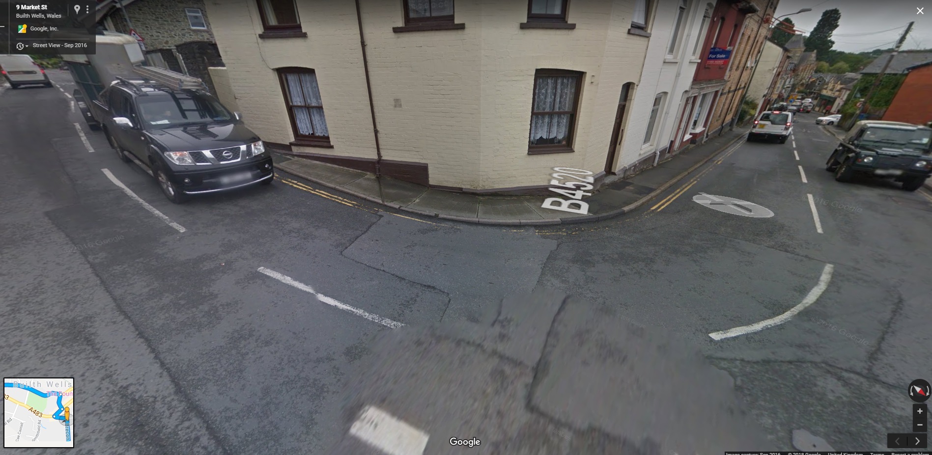
At the traffic lights on Market Street, turn left (Cotswold Outdoor Centre to your right).
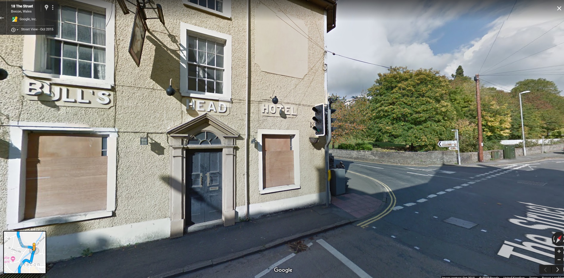
Then turn left again at the lights by the salubrious looking hotel below (towards Lower Chapel and Upper Chapel B4520 - signposted). Brecon Cathedral walls will be on your right.
This is a semi stage route back into the Beacons passing first through suburban Brecon and then out into the countryside and then up into the hills. A quick road with bends, long sweeping straights and views of the Beacons. We will pass through some villages on the way so the speed limit will obviously drop occasionally.
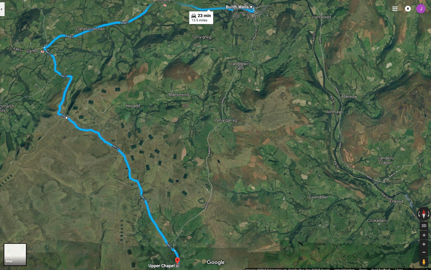
Stage 5. Upper Chapel -> Builth Wells (A4250)
Simple route - tough to get lost. Shortly after Upper Chapel there’s less hedges/trees, more moorland and weapons ranges! Red Flags = Live Firing. Mad Max 2 type roads - enjoy.
Descending into Builth via Llandewi’ir Cwm, things get a bit more sedate and more leafy.
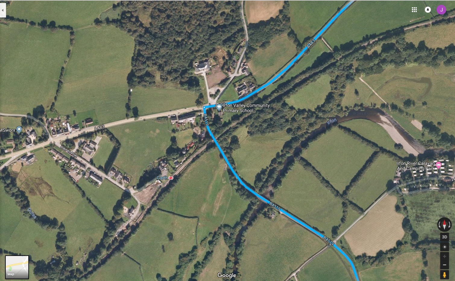
Stage 6. Builth Wells -> Garth (A483 staging route) -> Upper Chapel (B4519)
Close up of the run into Builth - note the left hander at the end of the B4250
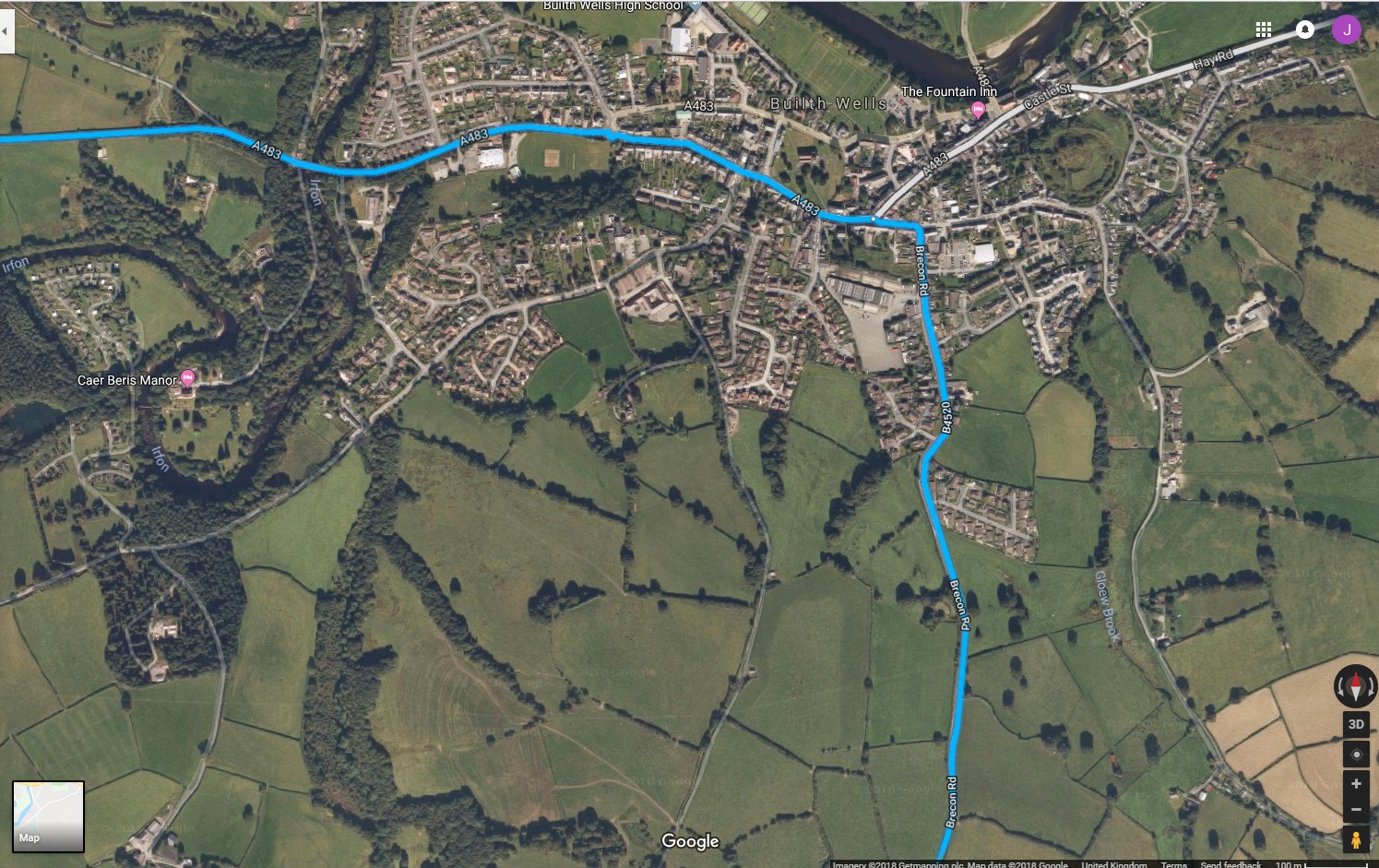
Follow the B4250 into Builth, the road bends left onto Market Street...
After this bend, just keep going along this road (ignore any Sat Nav, Google Maps instructions to the contrary trying to turn you right). The B4250 (Market Street) will become the A483, the staging road, towards Garth and the return southbound.
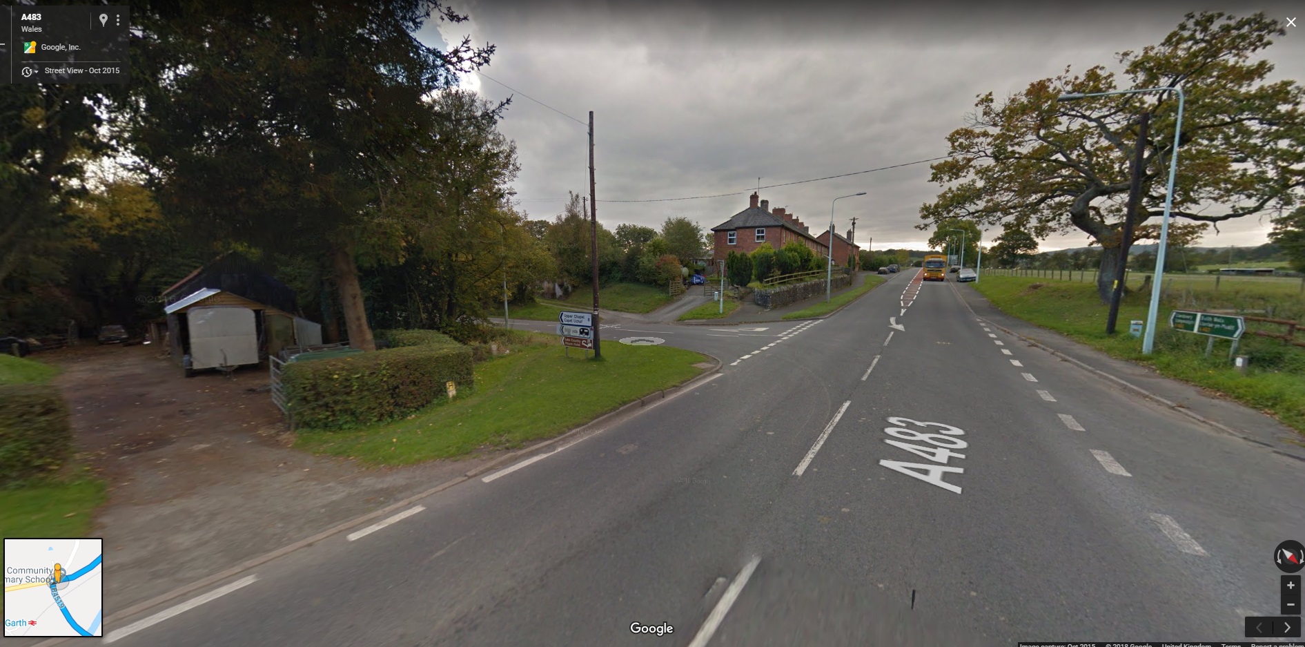
Continue on the A483 through Cilmery on towards Garth. Just before entering Garth take the left onto the B4519.
Ground shot of this left turn…
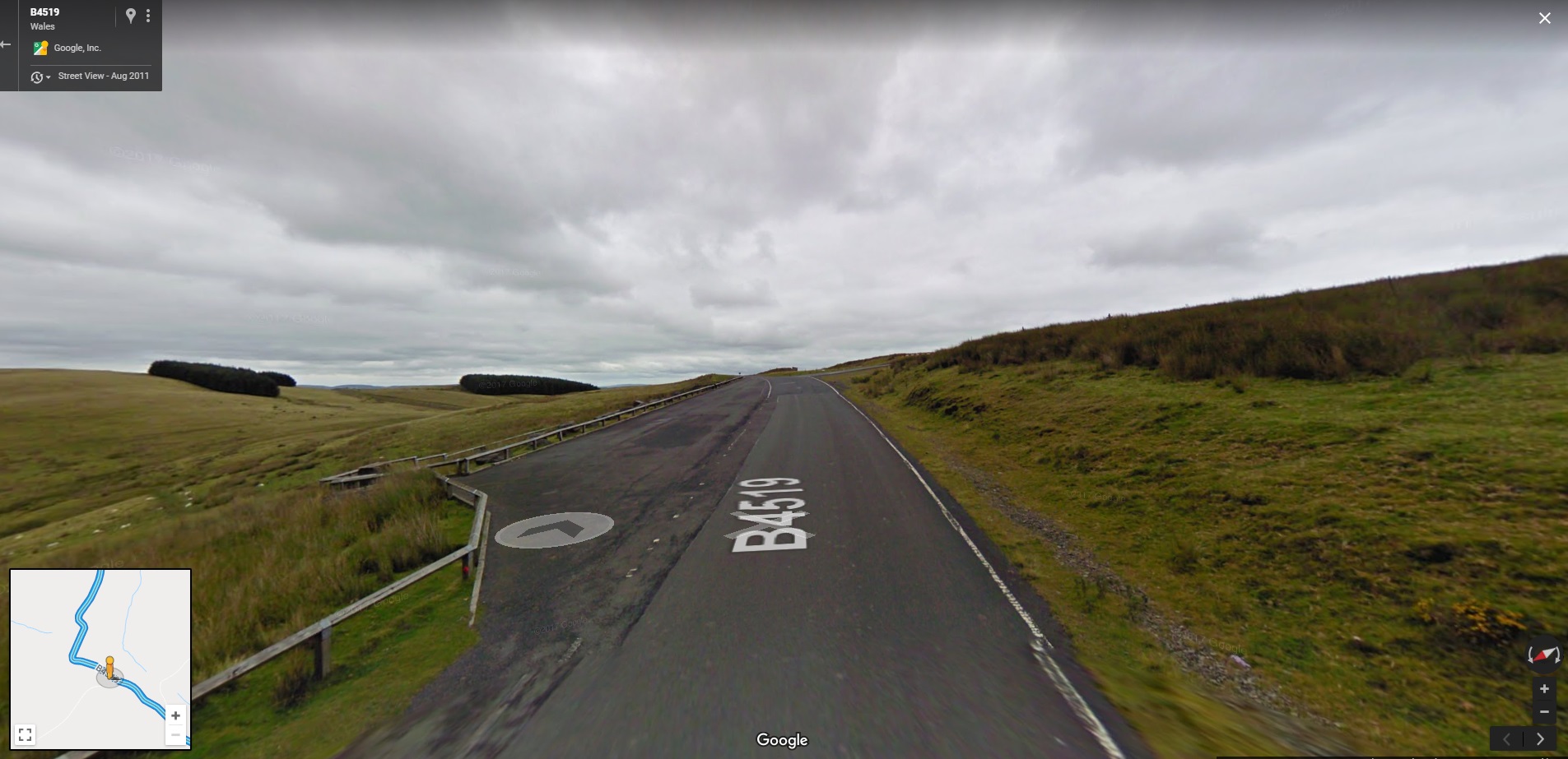
About a mile down the B4519 the landscape will change quickly (as you cross a cattle grid). It’s back into the Beacon moorlands with sheep and WMD ! Quite a few bends (NOT SIGN POSTED) and dips/climbs - keep alert along here - but should be fun. There is a fairly large layby on the left soon after another cattle grid as we enter the Beacons if we want to stop for a photo/chat (see below).
At Upper Chapel the road joins back onto the B4520 and its a return to Brecon via the same route in reverse (Stage 4, but we won’t be going back via Libanus).
Stage 7. Brecon -> Sennybridge (A40 Staging route)
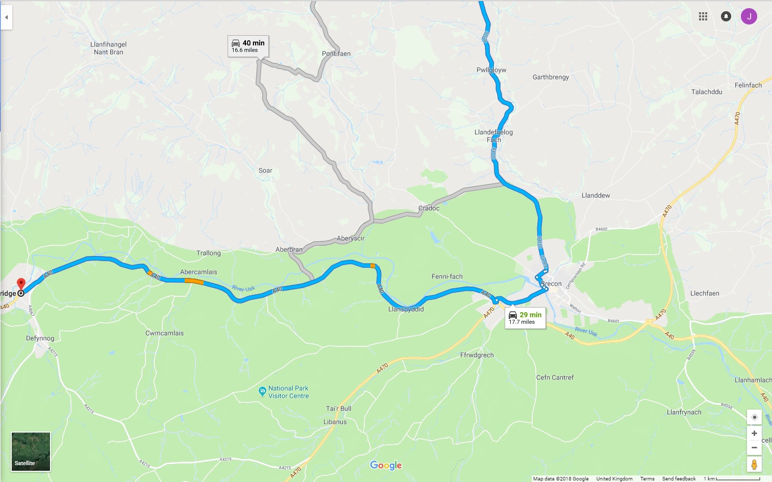
We follow the B4250 into Brecon (note there is an alternate, shorter, route via Cradoc. This is predominantly one car wide with a few bridges that look narrow on street view; so even though it looks pretty, I think we should play it safe and go via Brecon via the route enlarged below.
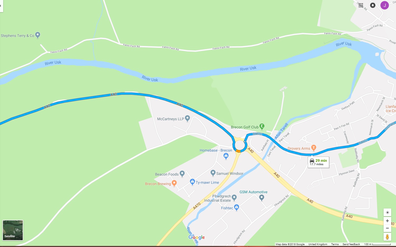
This is the same route as outbound with the exception that we will be turning north west, onto the A40, at the roundabout (as shown below).
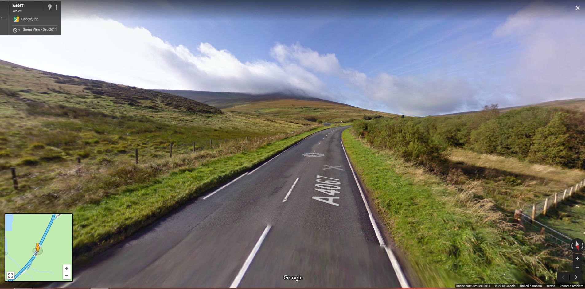
Stage 8. Sennybridge -> Abercraf (A4067)
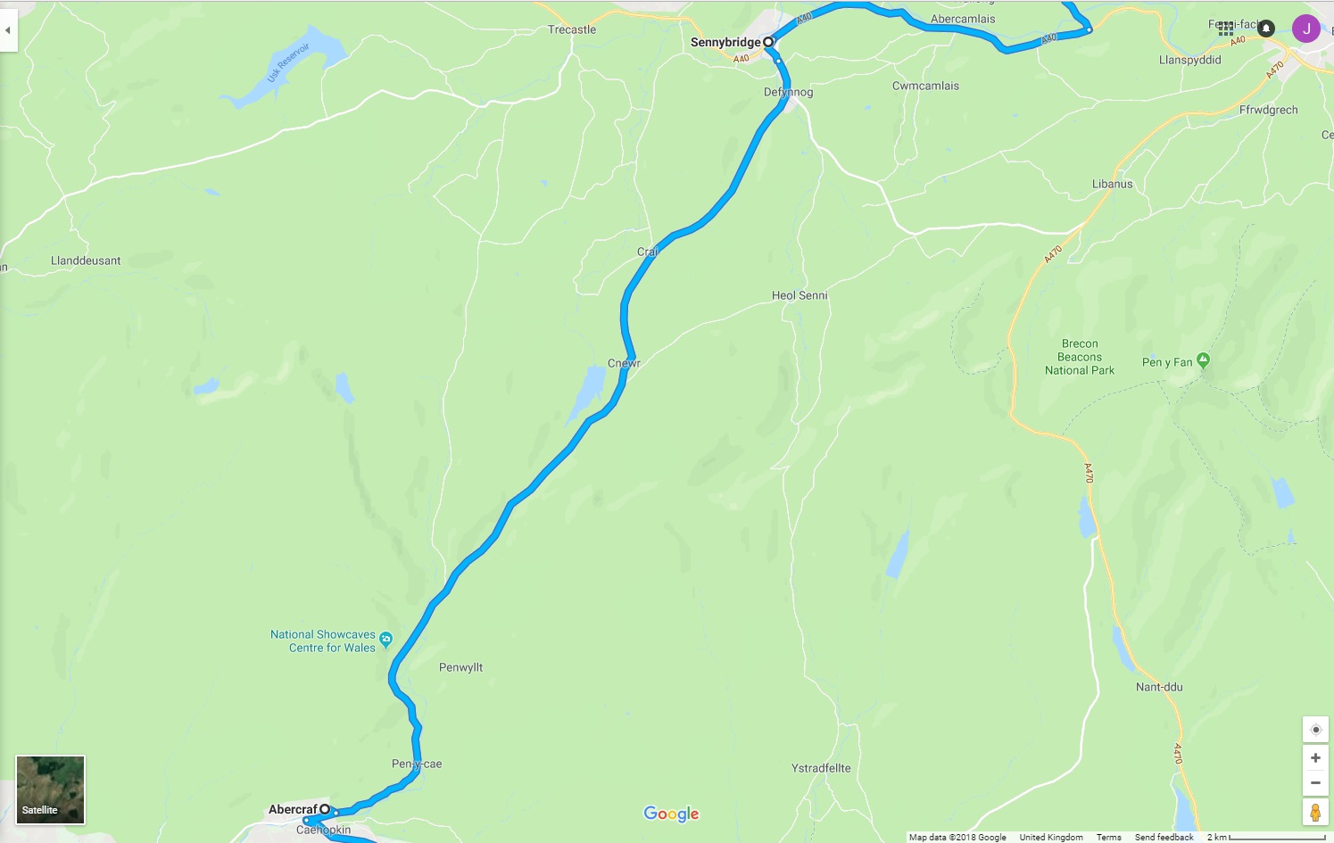
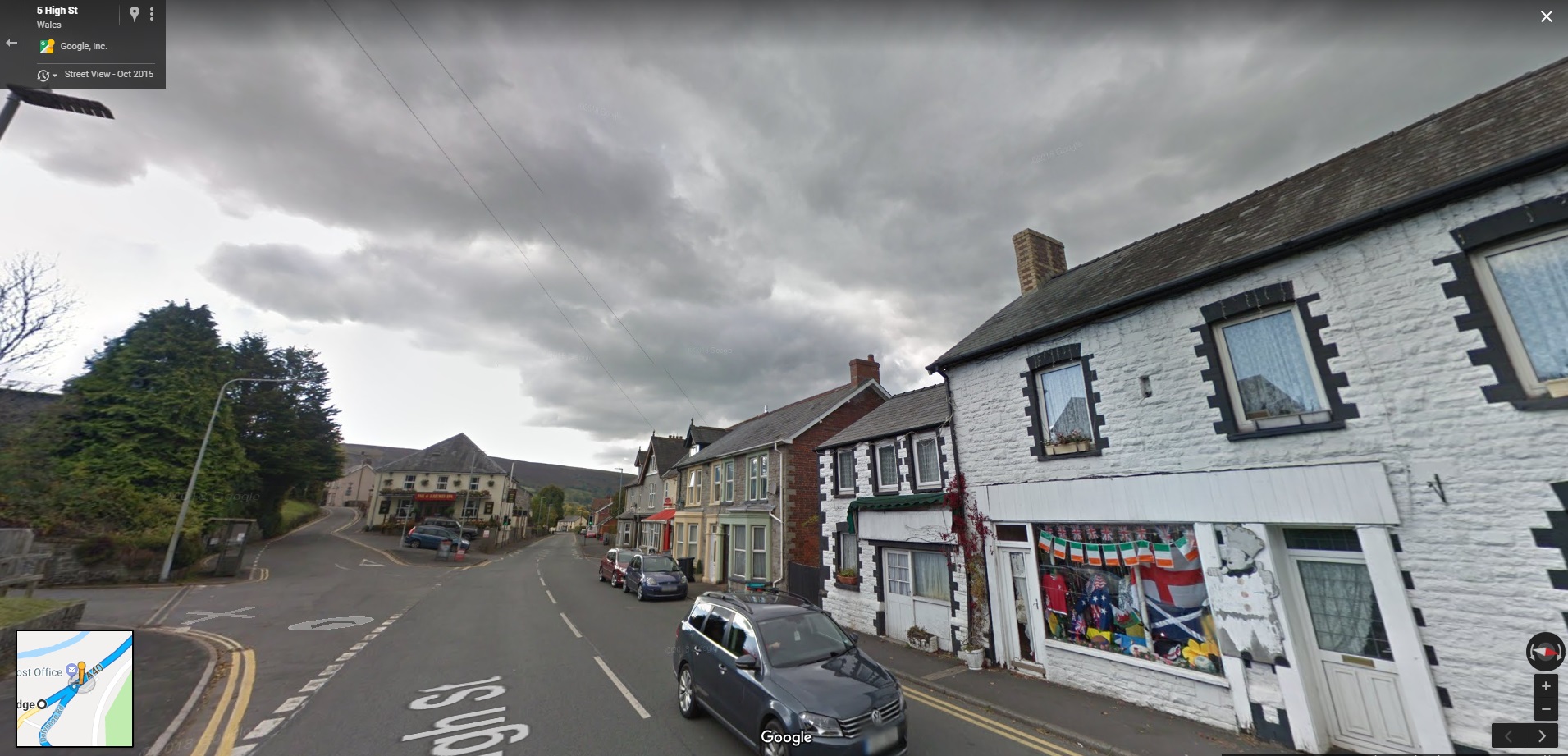
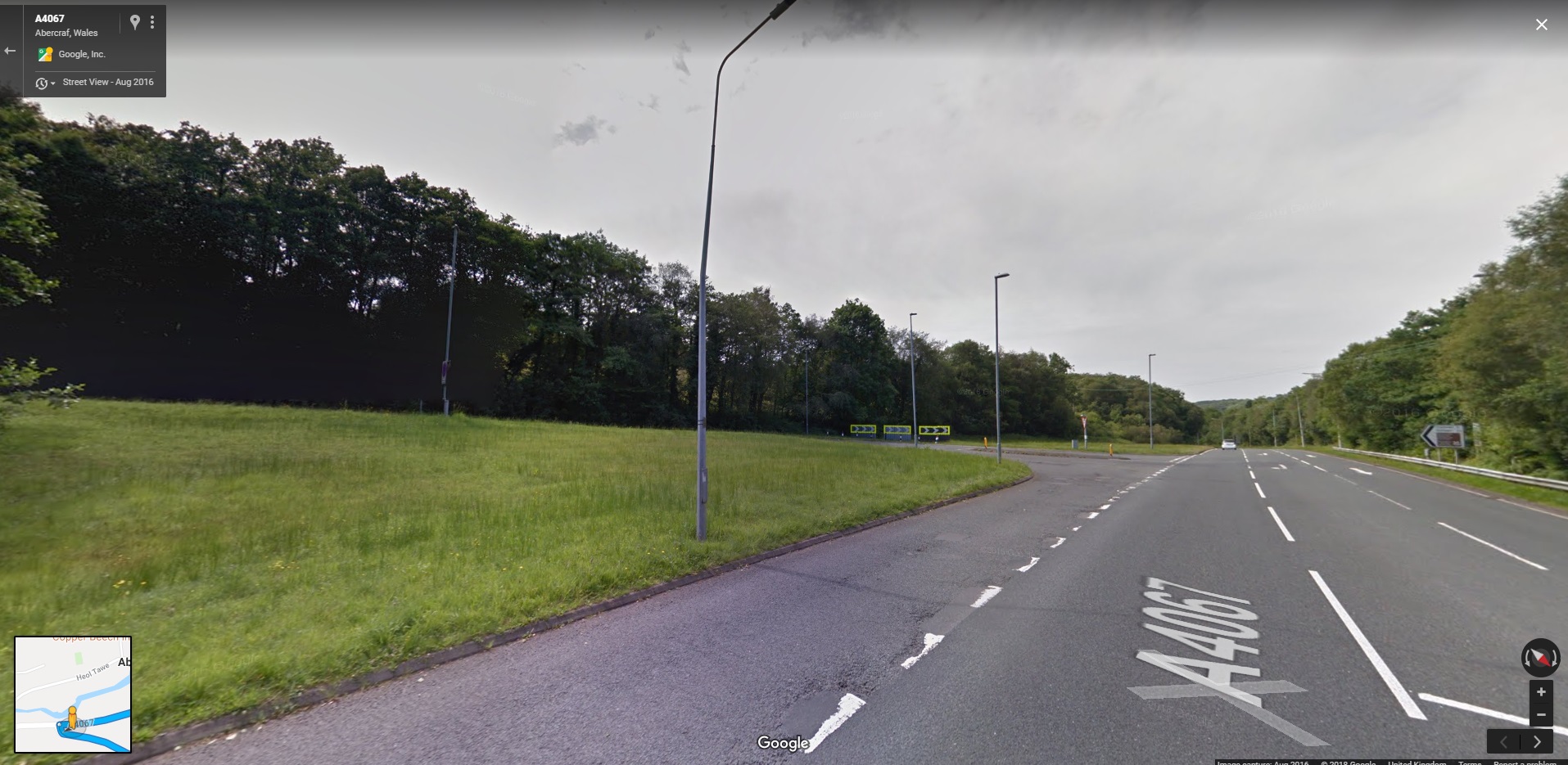
As we run along the A40 towards Sennybridge, we will be taking a left off the High Street onto the A4067 (left ‘fork’ in picture below).
Then its a few miles of ‘suburban’ driving before back out into the country. There is a fairly long ‘Roman’ straight section as we get into the countryside - which could be fun depending on traffic.
Once we’re through Craf, things open out again and this is the type of road we’ll be driving (long flowing bends being the norm).
Keep your eyes peeled along the way as you may get to see some Red Kites in the skies - we saw plenty when sighting the route so hopefully they’ll be back again.
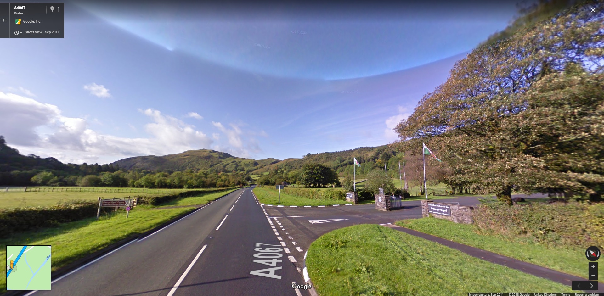
The National Showcave Centre is on this route (entrance below) and is worth a visit if in the area again. Very good for children, llama’s everywhere, fake dinosaurs and a beautiful cave system (what’s not to like ;) ).
Stage 9. Abercraf -> Hirwaun (Staging route via A4221/A4109/A465) -> Treorchy/ Sarn (A4061)
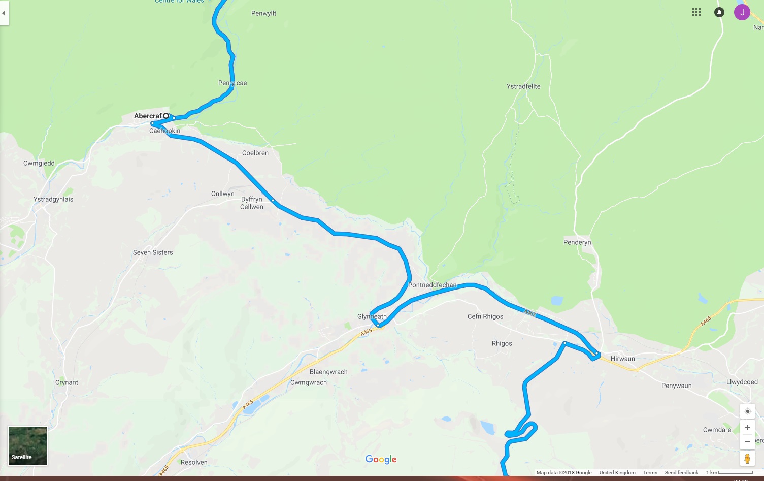
At Abercraf, take a left onto the A4221..
Once established on the A4221, nav to Sarn SuC and it should give you the correct route back. If not, nav to Glyneath, then Treorchy and finally Sarn. This route will take you onto the A4109 and then the A465 as you come through Glyneath.
After Glyneath, follow the A465 to Hirwaun and then south onto the A4061 (Rhigos Road)
The A4061 will be a reverse drive of Stage 1, but hopefully with a different viewpoint and take you back to Sarn.
OK, that’s finally it. This is just a taster of what is available in the area wrt driving roads and scenery, so hopefully we’ll all have a good time.
Any other briefing points will be carried out via the Messenger Group or on the day.